
How to Evaluate Flood Maps Before You Buy
A home can look perfect in a showing and still carry a flood-risk question that changes the monthly payment, insurance options, resale appeal, and renovation plans. Knowing how to evaluate flood maps gives you a better starting point, especially when buying near the coast, a bay, a creek, or low-lying areas of Northwest Florida.
Flood maps are useful, but they are not a simple pass-or-fail report card. A property outside a high-risk zone can flood, while a property in a mapped flood zone may have been built, elevated, and maintained in a way that makes the risk and insurance cost manageable. The goal is to understand the property-specific facts before you make an offer or remove inspection contingencies.
Start With the FEMA Flood Zone
Most buyers begin with FEMA Flood Insurance Rate Maps, often called FIRMs. These maps identify areas with different estimated flood risks. The zone shown on a listing, county record, or insurance quote is a starting point, not the final answer.
Properties in Special Flood Hazard Areas are generally marked with zones beginning with A or V. If you use a federally backed mortgage to purchase a home in one of these areas, flood insurance is typically required by the lender. Zone AE is common in many coastal and inland communities and includes a published Base Flood Elevation, or BFE. Zone VE is generally a coastal high-hazard area where wave action is part of the risk calculation.
Zones labeled X are often described as moderate-to-low risk. An unshaded Zone X is generally associated with a lower mapped risk than a Special Flood Hazard Area. A shaded Zone X has a higher, though still not high-hazard, mapped risk. Neither designation means “no flood risk.” Heavy rain, drainage issues, hurricanes, and storm surge can affect homes beyond the boundaries of a high-risk zone.
When reviewing a map, make sure the property marker is actually on the correct parcel. Map pins, listing portals, and broad neighborhood views can be inaccurate near a flood-zone boundary. A few feet can matter, particularly when a lot spans more than one zone.
How to Evaluate Flood Maps Beyond the Zone Label
The zone label tells only part of the story. Look for the effective date of the map and identify whether the home is near a boundary, a floodway, a drainage feature, or the coast. Older maps can remain in effect for years, and local conditions can change even when a map has not.
For homes in an AE or VE zone, compare the Base Flood Elevation with the lowest finished floor. The BFE is the elevation FEMA estimates water could reach during a base flood event. It is not a prediction of the exact height water will reach in every storm. Still, it is central to understanding construction requirements and flood-insurance rating.
A house elevated well above the BFE may be positioned differently from a nearby house that sits at or below it, even if both share the same mapped zone. This is why two similar-looking homes can receive very different insurance quotes.
Also look for a floodway designation. A floodway is the channel and adjacent area needed to carry floodwaters. Development restrictions can be tighter there, which may matter if you hope to add a garage, expand the footprint, rebuild after a loss, or make major site improvements.
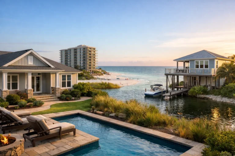
For coastal buyers, FEMA mapping should be considered alongside the property’s relationship to the Gulf, bay, canal, or nearby marshland. Map lines cannot capture every factor that affects a specific home during a storm. Site elevation, dunes, seawalls, drainage, roof condition, and the direction a property faces can all shape the practical risk picture.
Ask for an elevation certificate when available
An elevation certificate is one of the most helpful documents for a property in or near a mapped flood zone. Prepared by a qualified surveyor, engineer, or architect, it identifies key elevations for the structure. Depending on the home and insurance program, it may help an insurance agent develop a more accurate quote.
Do not assume an existing certificate is current or applies to every improvement on the property. Ask when it was prepared and whether the house, enclosed areas, mechanical systems, or grading have changed since then. For an elevated beach or waterfront home, details such as enclosed space below the living area can affect both coverage and compliance questions.
Verify Insurance Before the Offer Is Final
Waiting until the final days before closing to price flood insurance is a costly mistake. If the home is in a Special Flood Hazard Area, request flood-insurance estimates as early as possible. If it is outside one, consider getting a quote anyway. A lender may not require coverage, but the buyer may decide the protection is worthwhile.
Flood insurance can be available through the National Flood Insurance Program or a private insurer, depending on the property and the buyer’s needs. Cost and coverage terms vary. A low premium is welcome, but it should not be the only measure of value. Review deductibles, coverage limits, waiting periods, exclusions, and whether the policy addresses the structure, personal property, or both.
For a PCS buyer using a VA loan, the same early-review principle applies. VA financing does not remove flood-zone or lender insurance requirements. With a compressed relocation timeline, having the zone, elevation information, and preliminary insurance estimates in hand can prevent an unwelcome budget change late in the transaction.
Investigate the Home’s Actual Flood History
Maps estimate risk across an area. The property’s history reveals how that risk has played out. Ask the seller about prior flooding, water intrusion, insurance claims, remediation, drainage improvements, and any repairs made after hurricanes or severe rain events.
The seller’s disclosure is meaningful, but it should be paired with independent due diligence. During inspections, ask about staining, repaired drywall, moisture readings, crawl-space conditions, foundation vents, sump or drainage systems, and the age and location of mechanical equipment. In homes near the water, a specialist may be appropriate when the standard inspection identifies concerns.
Permit history can also provide useful context. Permits for substantial repairs, elevation work, roof replacement, drainage changes, or rebuilding may help you understand what the property has experienced and how it has been improved. They do not automatically prove that all flood-related concerns are resolved, but they can lead to better questions.
Compare the House to Its Immediate Surroundings
A neighborhood flood designation is not a substitute for looking closely at the lot. During a showing, note whether the driveway slopes toward the garage, whether neighboring yards drain toward the home, and whether street drains appear adequate. Look at the height of the house relative to the road and nearby homes.
In Panama City, Panama City Beach, Mexico Beach, and other coastal communities, buyers should also consider the trade-off between proximity to water and exposure to coastal weather. Waterfront access, views, and rental appeal can be valuable. They can also bring insurance, maintenance, wind exposure, and flood-risk considerations that need to fit the buyer’s long-term plan.
For inland properties, do not overlook localized drainage. A house can be far from the beach and still be affected by intense rainfall, ponding water, or nearby creeks. Ask neighbors when possible, but treat informal comments as one data point rather than a substitute for maps, inspections, and insurance review.
A Practical Flood-Map Review Checklist
Before moving forward, gather the documents and answers that actually affect your decision:
- The current FEMA zone and map panel for the specific parcel
- The Base Flood Elevation and floodway status, when applicable
- An elevation certificate, if one is available
- Flood-insurance estimates based on the actual property details
- Seller disclosures, repair records, and relevant permit history
- Inspection findings related to moisture, drainage, structure, and prior repairs
If the answers raise concern, that does not always mean walk away. It may mean adjust the offer price, budget for mitigation, negotiate repairs or credits, select different insurance coverage, or choose a property with a risk profile that better matches your comfort level.
Use Local Guidance Before You Commit
Flood maps are technical, and online property data can be incomplete or outdated. A buyer should have enough information to make a clear decision, not just enough to get to closing. That is particularly true when the home will be a primary residence, a beach property, or an investment expected to hold value over time.
Bradley Barnes Real Estate can help buyers organize the local questions, coordinate the right due-diligence steps, and keep flood considerations in view alongside price, inspections, financing, and timing. The best next move is simple: evaluate the map early, verify the property details, and give yourself room to make a decision you can stand behind.